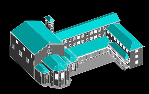
Scan to BIM
From Laser Scan to Intelligent Building
Models
At Cartospatial Technologies, our Scan to
BIM services transform raw 3D laser scans of buildings and infrastructure into
fully detailed, intelligent Building Information Models (BIM). This
cutting-edge process supports renovation, construction, facility management,
and heritage conservation by creating accurate, data-rich 3D models.

Key Features of Our Scan to BIM Services
- ✅
High-Precision 3D Laser Scanning
- Capturing
millimeter-accurate point clouds of interior and exterior spaces
- Suitable
for commercial, residential, industrial, and heritage sites
- ✅
Intelligent BIM Modeling
- Creating
parametric BIM objects with embedded metadata
- Supports
Revit, ArchiCAD, AutoCAD, and other BIM platforms
- ✅
As-Built Documentation
- Accurate
reflection of existing conditions for renovations and retrofits
- Minimizes
costly errors and rework during construction
- ✅
Clash Detection & Coordination
- Integration
with MEP and structural models to identify conflicts early
- Enhances
project collaboration and reduces delays
- ✅
Heritage & Conservation Modeling
- Detailed
modeling of complex historic structures
- Enables
preservation planning with precise data
- ✅
Facility Management Integration
- Embedding
spatial data with asset information for maintenance
- Facilitates
lifecycle management of buildings
- ✅
Scan Data Registration & Cleanup
- Processing
of raw scans for noise reduction, alignment, and completeness
- Creating
seamless, comprehensive datasets
- ✅
Customized Deliverables
- 3D
BIM models, 2D plans, elevations, sections, and schedules
- Export in multiple formats (RVT, IFC, DWG, PDF)

Applications
- Renovation
and retrofit projects
- New
construction verification
- Facility
and asset management
- Heritage
building documentation
- Clash
detection and coordination in design phases
- Energy
analysis and sustainability modeling
- Space
planning and interior design
- Construction
progress monitoring
Deliverables
📍
3D BIM Models
- Parametric
models with embedded object properties
- Compatible
with Autodesk Revit, ArchiCAD, and IFC standards
📍
2D Drawings
- Plans,
sections, and elevations extracted from the BIM model
- Annotated
and dimensioned for construction use
📍
Scan Data Registration
- Cleaned
and georeferenced point cloud datasets
- Aligned
scans with coordinate system references
📍
Clash Detection Reports
- Identified
model conflicts with recommendations
- Coordination
meeting visuals and marked-up plans
📍
As-Built Documentation
- Accurate
reflection of existing site conditions
- Comprehensive
documentation for project handover
📍
Facility Management Data
- BIM-integrated
asset information
- Maintenance
schedules and spatial analytics
📍
Visualization & Walkthroughs
- Rendered
images and interactive 3D walkthroughs
- Helps
stakeholders visualize design intent
📍
Project Reports & Metadata
- Scan
details, software used, and quality assurance logs
- Complete
traceability for audit and compliance
With Cartospatial Technologies, your Scan to BIM process bridges the physical and digital worlds. We deliver intelligent, actionable models that streamline design, construction, and facility management—saving time, costs, and reducing risk.